Leave No Dot Behind
Writer Brady Bergeson joins photographer Andrew Filer for an afternoon of "dot" hunting and gives us the skinny on the "Everydot Project" and why this artist aims to document every small town on the official Minnesota highway map.


WE ARE DRIVING SOUTH OUT OF MOORHEAD ON HIGHWAY 75, past the wooden skeletons of new homes going up on the city’s edge. It is early afternoon and a thin layer of clouds has left the day bright, but tinted gray. Our first stop is Comstock (population 125), fifteen miles from here down a two-lane highway that cuts across pristine, snow-covered fields.
Andrew Filer, a photographer and conceptual artist, is sitting in the passenger seat. He is a large man in his mid-twenties, and from his physical presence one gets the impression that he could have played offensive lineman for a small, Midwestern private college. His head is shaved to stubble, as is his face, and thin wire-rimmed glasses hint at the intellectual subtleties of his artistic vision. His voice has the promise of an accent, maybe Canadian or vaguely English, but apparently it is just what someone who was raised outside of Thief River Falls sounds like.
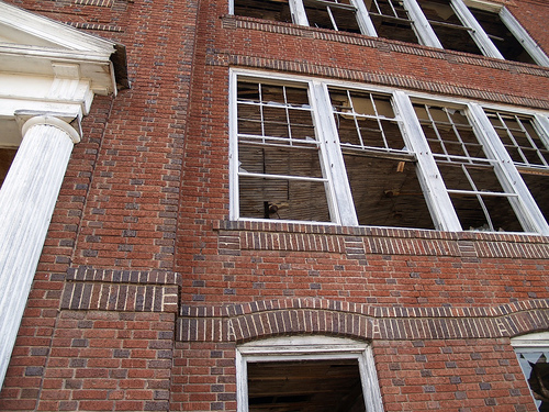
As we turn off the highway into Comstock, I immediately notice a two-story, yellow-brick schoolhouse with boarded up windows; graffiti reads “God sees you,” with a giant eyeball painted alongside. It is easily the largest, most historic building in this tiny town and the most likely subject for any visitor armed with a camera. But as I stop the car in front of the schoolhouse, it becomes apparent that Filer is not an ordinary visitor.
“I wouldn’t necessarily feel compelled to photograph this,” he says. “It’s a distinctive thing, but it’s not the first thing I see.”
Filer has spent a lot of time photographing small towns. A lot. In the past six years he has compiled more than 4,000 photographs of more than 300 towns. He plans to photograph every town in North Dakota and Minnesota, and perhaps beyond. It is a project he calls “Everydot,” as in every dot on the map.
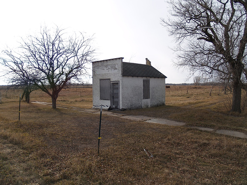
But his project is not about chronicling small town life or documenting the decay of such places. That would be too easy. Those are, in fact, responsibilities that Filer rejects, though he has forced himself to photograph some of the things people might expect, like grain elevators and disheveled yards. But listen to Filer talk for more than a few minutes and you begin to understand that the way he sees these “dots” is in relation to something much bigger.
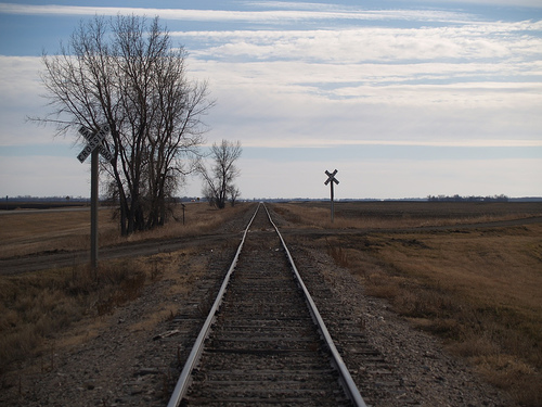
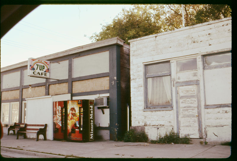
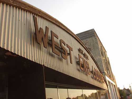
“Some of the interesting things about these towns are the invisible or almost invisible things of infrastructure,” he says. And that’s what you see in his photographs. Railroad tracks. Old roads. Intersections. Worn paths. Overgrown railroad beds. Signs, lots of signs. Town markers. Storefronts long abandoned. The project began as an impulse to collect images of graphic design that had survived over the decades, many of which could be found in small towns.
“A lot of railroads have been torn up and so there are varying degrees of visibility of where the railroads were,” he says. “I’ve found some of the tiniest ‘dots’ along railroad lines that have been torn up. In some of them you see only really subtle things in the earth, like a mound that is [all that’s left of] the railroad line. For some towns [it’s] the only thing I have that indicates to me it’s a town—and only because I already know to look there. The confluence of these things made a town.”
Filer admits that his mass of photographs is a bit of a mess. “Everything I put up is everything I take. Some of the photos are badly done, but it’s sort of an Open Source thing for now. At first I just had a hoarding mentality—I just wanted a picture, but it wasn’t about making a good picture.”
In some ways, this is the point of the Everydot project. Taken as a whole, this collection of photographs is representative of a system of places made by the unique hands of thousands of people over the course of more than a hundred years. Look through the photographs and what you see is a mess, buildings left to rot, roads no longer traveled, signs for products no longer sold. And that’s in keeping with his other projects, which include something he calls “Extant Design,” a collection of products whose package designs haven’t changed under the pressure of modern graphics, and a conceptual art piece dubbed Municipal Water Board, an online document he created with a manual typewriter for a fake governmental agency, changing the ribbon to red for hyperlinks. In a particularly ambitious bit of work Filer digitized the entire 41-year press run of the Holt Weekly News, writing his own software to not only make it viewable, but to enable web searching throughout.
As we pull into Wolverton (population 114), Filer points out a small door embedded in the foundation of an old house. “I believe that’s a coal chute,” he says. “They would have had their delivery of coal dumped in there to the basement. It’s a tiny infrastructure thing you begin to see. I start noticing smaller and smaller details.”
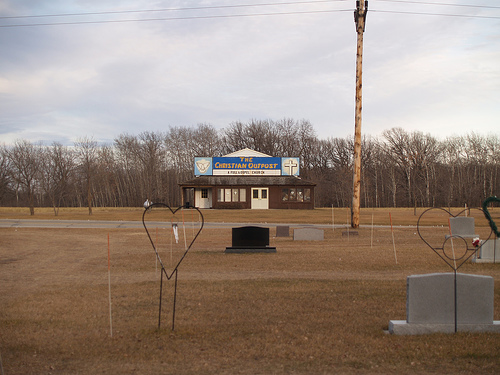
By now, Filer has changed the way I see this small town. Yes, there is the giant grain elevator, the brick schoolhouse, the weathered paint of the homes. But I’m noticing the things underneath the obvious fixtures of a small town, those things that connect it to the other small “dots:” the roadways, rail lines, telephone lines, and the remnants of these connectors that persist, but now lay unused.
It is this system evident in the details of infrastructure old and new that interests Filer. He is the curious kid ripping apart a computer (another old hobby of his) to see how it works and, by compiling photographs of these “dots” on our landscape, he’s holding up the motherboard for all of us to see.
“We have these things that are conceptual, like route numbers,” Filer says. “We have paths that used to exist but there are no markers left except roadside architecture. I end up seeing different paths and lines that connect places in different ways.”
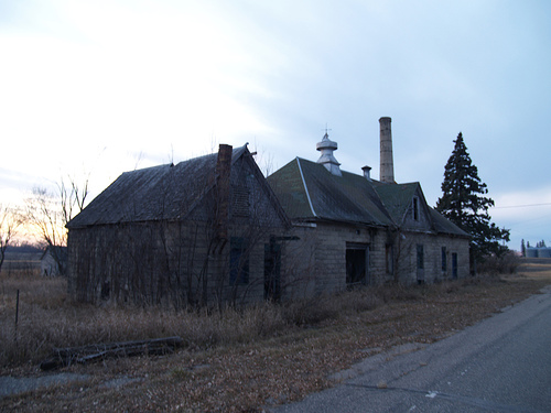
We are driving from Kent (population 116) toward the Red River and come upon three houses along the road. Filer spots a small wood building, obviously long abandoned, set off by itself in a field behind one of the lots. It has a tall, false front on it that Filer recognizes as a storefront. He quickly leafs through a detailed road map in his lap, scouring for a possible “dot.”
McCauleyville.
There is no sign for McCauleyville, and as we pass the homes at fifty miles per hour I wonder if the people of McCauleyville know they live in McCauleyville.
About the artist: Andrew Filer photographs aging urban areas and small towns, with a focus on vernacular signage and design. He spent the first 18 years of his life in Thief River Falls, Minnesota. That region’s flat landscape, sparse population, and long summer sunsets can be seen in Everydot, his project to photograph every town listed on the official Minnesota highway map. Andrew doesn’t simply photograph, he designs and builds the back-end software necessary to make it available to everyone. His computer science background helped build HoltWeeklyNews.com, a searchable archive of the entire run of a small-town newspaper. He believes that the principles of Open Source can be applied as much to art as to computer science, so his photo projects, books (including Sunsets, a compilation of photos taken facing away from the sun at dusk), and Open Source contributions can be seen at afiler.com.
About the writer: Brady Bergeson is a writer living in Fargo, North Dakota. He’s a member of the Minneapolis-based Lit 6 Project and the popular podcast and stage production Electric Arc Radio show (which you can see at the Ritz Theater in Northeast Minneapolis). Brady also teaches at Minnesota State University Moorhead. If you’re curious, a+E profiled Electric Arc Radio in a recent issue: check it out.